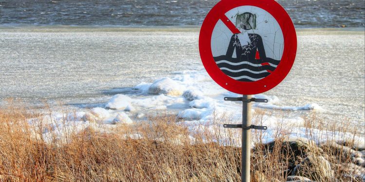
A four-year trend of mild winters could be over
The latest long-term winter forecast from DMI indicates that the coming winter months will be colder and maybe more winter white than what the past four years have been.
By Bente D. Knudsen Picture: Hisham Ammar
You may have gotten used to the relatively mild Danish winters, certainly if you have only lived here for a couple of years.
According to the latest long-term update for the coming winter months, the winter 2017/2018 could turn out much colder than what we have gotten used to.
Colder because the wind and weather will be influenced more by the east than the west. This means that high-pressure systems build up over Scandinavia and prevent the normally mild and humid western winds from reaching Denmark.
The likelihood of this happening has increased in the updated forecast from Denmark’s Meteorological institute (DMI). December it seems will still be very unstable weather-wise with frequent changes between mild and grey weather, and colder and dryer spells.
The article continues below.
Whether or not Denmark will have a white Christmas is still too early to predict, however DMI expects December to be a great deal colder than the previous years. With the cold comes also dryer and sunnier weather.
In January and February, the normally coldest winter months, it seems that 2018 will break the warm four-year trend and instead offer the normal average temperature of around 0 degrees Celsius.
Denmark could also experience longer spells with frost, which will mean that lakes freeze over and enable wonderful outdoor ice skating to take place. Something that has been rare the last four winters. Also a larger part of the downfall will be as snow instead of rain.
The reason for the colder winter forecast is the weakening of the polar vortex, in Danish polarhvivlen, which builds up each winter around the north pole.
It dominates the weather of the Danish winters, and when the North pole vortex is weakened it also weakens the jet stream – which influences the Danish weather – and with a less strong jet stream it prevents the low pressure systems with mild and humid weather from reaching Denmark.
When the jet stream is weakened or deviated from its normal positions over the North Pole, then the colder arctic air can flow south and reach our latitude.
The article continues below.
At the moment the indicators for a cold winter are stronger than the ones for a mild one – however of course forecasts and models are complicated, as DMI points out.
The weather is monitored closely by DMI and they seem quite convinced that the four year trend of mild winters will be broken for the 2017/2018 one.
So if you did not yet gear up for colder weather – maybe that could be part of your Christmas wish list this time.
In general when it is cold, it will especially be cold during the night and in the early morning. This mean that drivers and cyclists need to be careful about icy roads and bicycle lanes when they go out.


